Interlaken, the hikers' dream
Découvrez les 5 randonnées incontournables dans Interlaken recommandée et testée par notre super équipage
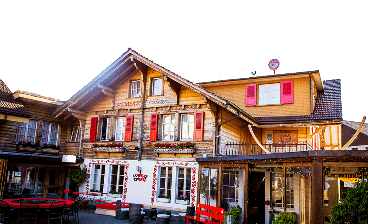
L'une des, sinon la principale raison pour laquelle Balmers Hostel est si populaire, est la facilité d' accès à un grand nombre de randonnées fantastiques Juste sur le pas de la porte ou un court voyage en train pour se rendre au début du sentier.
Randonnées faciles aux alentours d’Interlaken
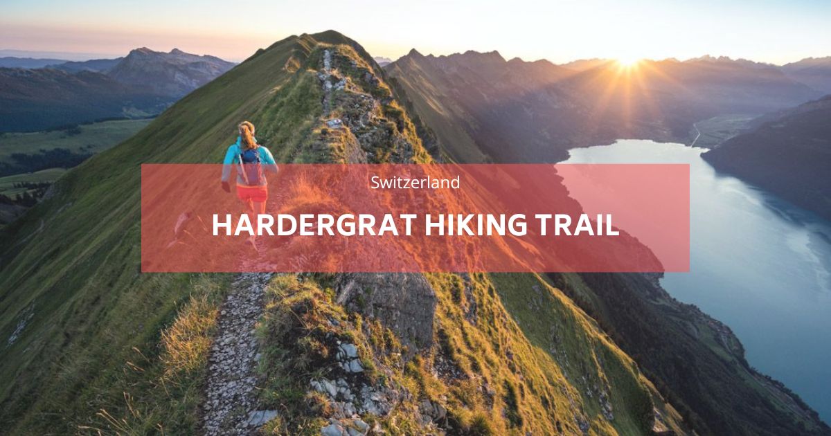
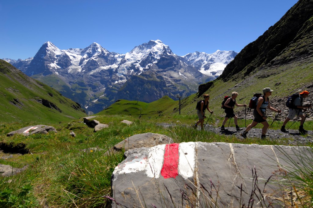
À moins que vous n'émettiez des murs ou des rigorations, aucun des sentiers de cette région ne nécessite de compétences d'alpinisme ou d'équipements spécialisés importants. Les sentiers de randonnée en Suisse sont tous incroyablement bien marqués et indiqués, vous ne devriez donc avoir aucun problème lorsque vous êtes en randonnée pour vous perdre ou être en grand danger. Il y a plus de 70 sentiers marqués sur la carte de randonnée d'été, Et cela n'inclut pas certains des plus à distance, comme le Grat plus dur, ce qui n'est pas aussi simple que les articles de blog que vous lisez.
La
Les meilleures randonnées dans la région de Jungfrau
Avant de vous lancer dans l’aventure, il convient de noter que le transport peut représenter une part importante de votre budget. Pour économiser de l’argent, pensez à l’un de ces pass de voyage populaires :
- Pass de voyage pour la Jungfrau: Couvre les voyages illimités dans la région de la Jungfrau.
- Pass Oberland bernois: Comprend des régions comme Berne, Lucerne et Interlaken.
- Pass de voyage suisse : Offre un accès illimité aux transports publics dans toute la Suisse.
- Carte suisse demi-tarif: Offre une réduction de 50 % sur la plupart des billets.
- Carte d’invité Interlaken
Pour plus de détails sur les pass de voyage, consultez notre article de blog : Comment se déplacer à Interlaken.
La
Où faire de la randonnée à Interlaken?
1. Le Rügen
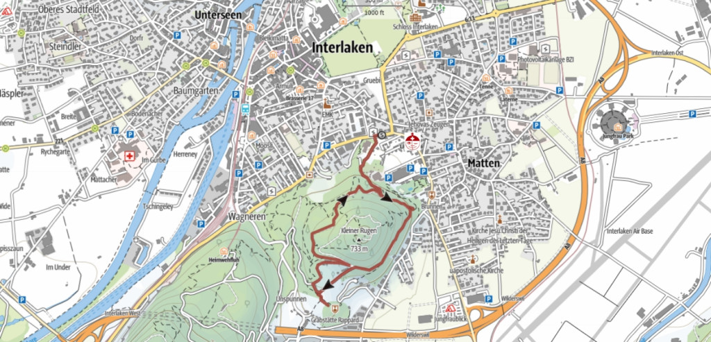
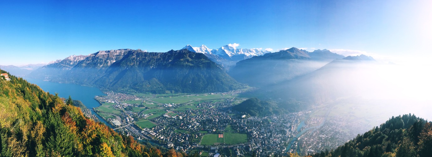
Ce point de départ est situé à À 5 minutes à pied de la l'auberge n’est qu’une randonnée rapide de 30 à 40 minutes jusqu’au sommet et n’est pas si difficile, si vous savez que vous n’êtes pas aussi en forme que vous le souhaiteriez ou si vous voulez tuer une heure ou deux en faisant autre chose que de vous asseoir sur votre téléphone, alors c’est celui qu’il vous faut. Vous obtenez de superbes vues sur Interlaken et les deux lacs, et cela vous offre une vue à 360 degrés d'Interlaken.
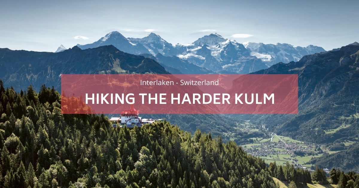
2. Le Harder Kulm
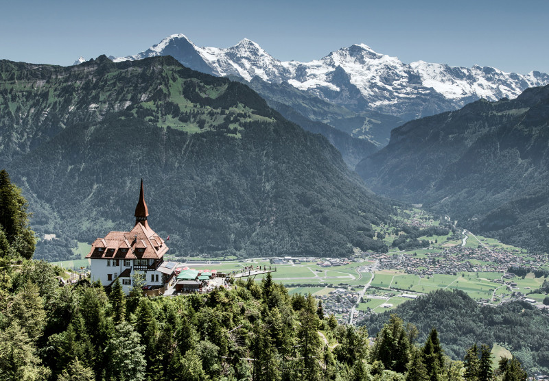
Suivant sur la liste et une étape sur l'échelle de difficulté de randonnée, et le pas en place est assez considérable. L'augmentation de la difficulté est dans le fait qu'il n'y a pas de sections plates sur le kulm le plus dur; ce n'est que de la montée sur le trajet aller et que de la descente sur le trajet retour Si vous n'utilisez pas le funiculaire. Vous pouvez toujours prendre le funiculaire vers le haut ou vers le bas au cas où vous seriez fatigué. N'oubliez pas d'utiliser la carte de votre visiteur lors de l'achat de votre billet pour un tarif réduit. La randonnée est d'environ 1,5 heures dans les deux cas, et le sommet ne décevra pas. Ils ont un point de visionnement de sol à fond de verre incroyable où vous voyez les majestueuses montagnes Jungfrau, Mönch et Eiger. Il y a même un petit restaurant cool qui était un vieux monastère où vous pouvez profiter du déjeuner ou d'une bière rafraîchissante!
- Veuillez lire notre article de blog sur Randonnée dans le Kulm plus dur en détail ici
- Depuis Harder Kulm, vous pouvez également démarrer le Randonnée à l'Augstmatthorn
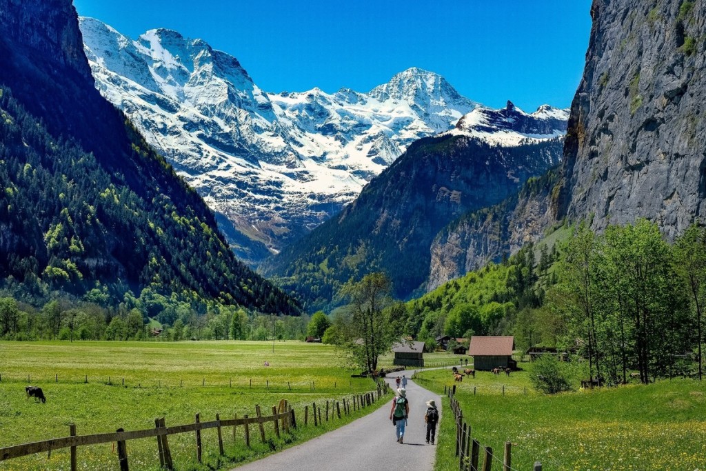
3. Lauterbrunnen : la vallée des 72 cascadess
Lauterbrunnen est l'une des destinations de randonnée les plus emblématiques de la région de la Jungfrau, offrant un mélange de promenades en plaine et de sentiers de montagne panoramiques. Celui-ci est plutôt une boucle passant par le fond de la vallée de Lauterbrunnen puis par le sommet. Il peut être divisé en sections si vous ne souhaitez pas parcourir toute la distance.
Voici notre itinéraire recommandé d’une journée complète :
- Commencez votre randonnée à Grutschalp
Depuis Lauterbrunnen, prenez le téléphérique jusqu'à Grutschalp, où se trouve le départ du Mountain View Trail. Cette route panoramique dure environ 2 à 3 heures et vous mène au village pittoresque de Mürren. - Explorez Mürren et le sentier North Face
À Mürren, vous pouvez soit vous promener dans ce village alpin sans voiture, soit affronter le North Face Trail, une boucle offrant une vue imprenable sur les sommets environnants. - Descendre à Gimmelwald
Les randonneurs aventureux peuvent essayer le Via Ferrata route de Mürren à Gimmelwald (en savoir plus dans notre Guides de via ferrata). Vous pouvez également vous promener tranquillement jusqu'à Gimmelwald, un village pittoresque où vous pourrez acheter des produits frais dans les réfrigérateurs du système d'honneur approvisionnés par les agriculteurs locaux. - Terminez par une promenade dans la vallée
Depuis la gare de Stechelberg, suivez un sentier plat jusqu'à Lauterbrunnen. Cette promenade paisible à travers la vallée est le moyen idéal pour terminer votre journée.
Pour un guide détaillé, consultez notre article de blog sur Randonnée à Lauterbrunnen et que faire à Lauterbrunnen.
4. Grindelwald : centre d'aventure alpine
Grindelwald est le point de départ idéal pour les randonneurs, offrant des sentiers allant des promenades relaxantes aux aventures alpines stimulantes.
You need to take a short 30-minute train to get here, but once there, it is an open valley, sunny for most of the day, and you are at the base of the famous Eiger North Face, which is an alpinist's dream.
- Incontournable : première promenade sur les falaises
Prenez le téléphérique jusqu'à First pour le célèbre First Cliff Walk, une expérience passionnante mais accessible offrant une vue imprenable sur les sommets environnants.
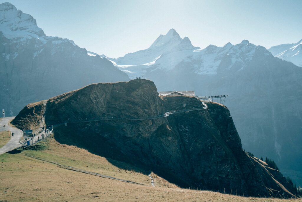 Vous pouvez prendre une gondole jusqu'à la nouvelle promenade Tissot Cliff rattachée au restaurant du First. Vous pouvez toujours faire de la randonnée de Grindelwald à la première fois, qui est à environ 3 à 4 heures. La majorité est sur un chemin pavé, donc le sentier est incroyablement facile à suivre avec peu de navigation.
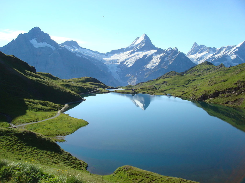
Lorsque vous arrivez au début et que vous avez pris votre part de selfies sur la falaise, il y a l'option supplémentaire pour continuer pendant 1 heure 1 Way to Bachalpsee, qui est un lac glaciaire situé à plus de 2000m au-dessus du niveau de la mer. Les mots et les images ne lui rendent pas justice. Il ressemble à une piscine à débordement avec une vue, et est le plus populaire pour un cadre d'engagement surprise! Clin d'œil clin d'œil…
Le sentier est parsemé de fleurs sauvages alpines, de vaches avec des cloches et de vues glaciaires à couper le souffle, et est un must pour quiconque visite la région. Encore une fois, en raison de l'infrastructure de transport de Suisse, vous pouvez accéder d'abord via le téléphérique si vous souhaitez reposer vos jambes pendant votre séjour ici, si vous avez durement frappé les sentiers.
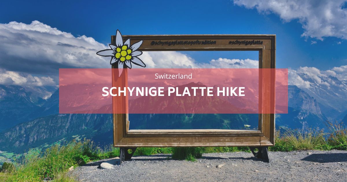
- Schnynige Platte au premier
Pour une randonnée plus longue et plus gratifiante, commencez à Schynige Platte (accessible en train de Wilderswil) et suivez un superbe sentier de 5 heures le long des crêtes et des lacs alpins, terminant au début.
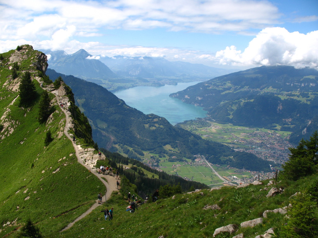
For a total of 32.5km long with 2378m of elevation up and 1918 elevation down. It starts in Wilderwil, which is a few minutes' bus ride from the hostel, and then rises up to the Schynige Platte. The Schynige Platte is where 16.2km of this trail starts, which is the main chunk of it, and it cannot be skipped with public transportation. The end of this section finishes at First, which is previously mentioned in the last hike, and offers you the choice if you are too tired to carry on to ride a cable car back down to Grindelwald. You can also take the charming original wooden train up and hike around the top of the Schynige Platte area.
Lisez notre article de blog sur la randonnée en Schynige Platte ici.
- Sentiers de l'Eiger
Rapprochez-vous de la légendaire montagne de l'Eiger avec des options comme la randonnée du Männlichen à l'Eigergletscher ou l'Eiger Trail. Pour les amateurs de sensations fortes, la Via Ferrata Rotstock offre une aventure inoubliable.
Pour des guides détaillés, visitez nos articles sur :
- Meilleures randonnées autour de Grindelwald,
- Guide complet de la via ferrata
- Organisez votre voyage à Grindelwald-First.
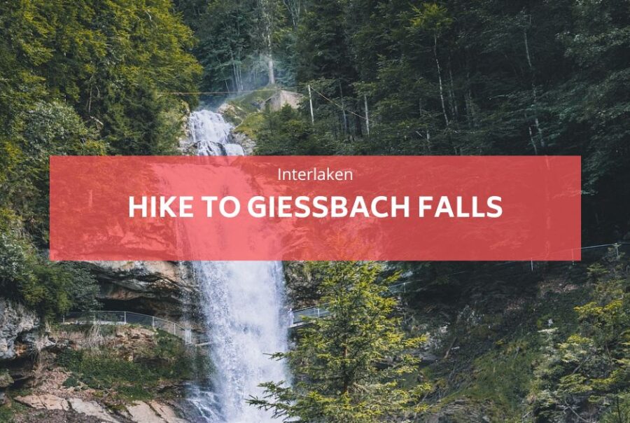
5. Chutes de Giessbach : une randonnée relaxante d'une demi-journée
Pour une expérience plus décontractée, la randonnée jusqu'aux chutes de Giessbach est un choix parfait. Commencez à Iseltwald, charmant village au bord du lac accessible gratuitement avec votre carte d'hôte. De là, suivez un sentier essentiellement plat le long du lac de Brienz, en admirant des vues sereines.
La randonnée dure environ 3 heures aller-retour et vous mène aux superbes chutes de Giessbach, avec 14 niveaux en cascade. Vous voulez plus de conseils pour cette randonnée? Consultez notre article de blog sur le faire de la randonnée aux chutes de Giessbach.
Ce qu’il faut apporter pour votre randonnée dans la région d'Interlaken
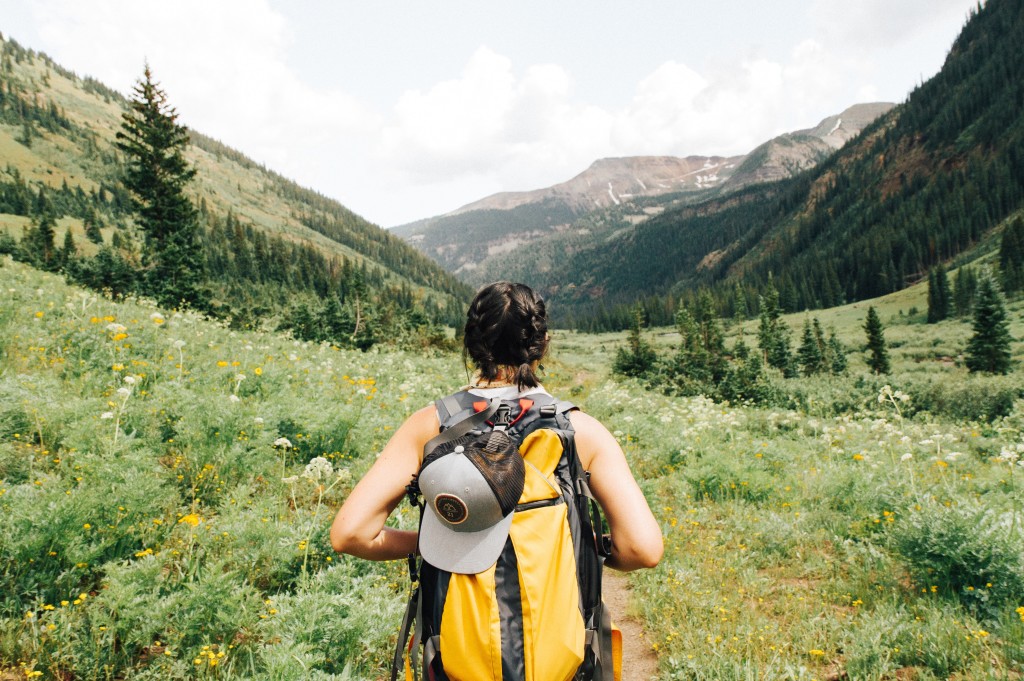
Toutes ces randonnées ne nécessitent pas grand-chose en ce qui concerne la planification et la préparation, sauf pour la météo à vérifier avec le personnel de la réception à Balmers Hostel Avant de partir, ainsi que des collations d'emballage et des aliments énergétiques, beaucoup d'eau, des lunettes de soleil et bien sûr, de bonnes chaussures de randonnée. Les entraîneurs feront très bien aussi, mais pas de tongs ni de talons hauts! Un appareil photo ou un téléphone est essentiel pour les centaines d'images Insta Glam dont vous pouvez vous vanter par la suite.
Comme pour toutes les randonnées, il est conseillé de transporter une veste de pluie même avec un ciel clair et un téléphone mobile fonctionnel au cas où vous auriez également des ennuis. Les étés suisses deviennent plus chauds que vous ne le pensez, Donc, un bloc solaire est essentiel; Arriver à l'auberge, ressemblant à un homard pourrait mettre un amortisseur sur vos plans pour les prochains jours.
Le bon sens prévaut et la plupart des habitants sont impatients de vous aider avec les questions.
Bon à savoir:
Vous pouvez rencontrer de petits réfrigérateurs à l’extérieur des fermes, à l’intérieur vous trouverez du fromage fabriqué localement, du lait, des boissons et des saucisses et jambons. Ceux-ci fonctionnent avec une boîte d’honnêteté, de sorte que vous pouvez vous servir et laisser de l’argent dans les boîtes où les agriculteurs le récupéreront plus tard.
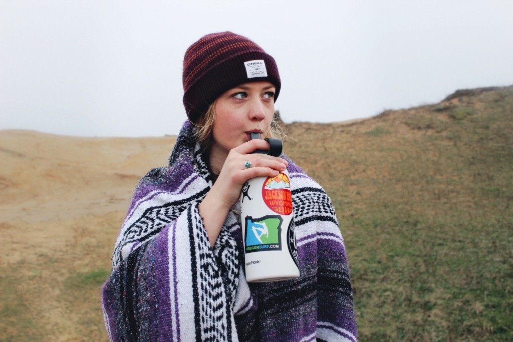
La Suisse a certaines des meilleures eaux potables, alors assurez-vous d'apporter une bouteille d'eau réutilisable (sauf la planète) et remplissez-la dans l'une des nombreuses fontaines d'eau. Cette eau provient directement du glacier, et la rumeur veut qu'il ajoute des années à votre vie! Gardez hydraté à tout moment!